Jan 19, 2022 | Activities/Services
Everyone knows that the most popular new year’s resolution is to do more exercise. A resolution that translates to a huge number of gym memberships and a huge number of cancelling and leaving said membership the next month.
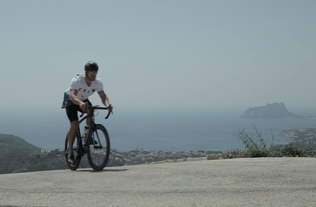
At VAPF, we support living a healthy lifestyle, and lucky us that our surroundings support exercise too! Especially when it comes to outdoor sports. That’s why for this 2022, we propose that your new year’s resolutions include exercise, but with a twist: that you exercise in and around Residential Resort Cumbre del Sol.
And what better way to work out than to cycle! It has many benefits: you can go long distances, do it with family whilst enjoying the countryside – both sea and mountain – and, of course, you’re working out every part of your body!
The Montgó Route
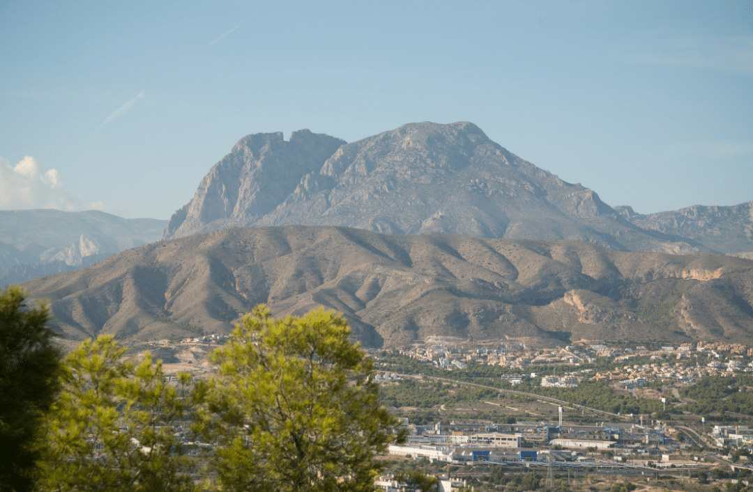
As we’ve said in other blog posts, the area surrounding Residential Resort Cumbre del Sol stands out for its beauty and versatility. With the sea being featured on pratically every postcard in the towns and cities of Costa Blanca, the mountain is another reason to go. One such place is the Montgo Natural Park in Denia. Its expanse and its over 700 metres in height turn it intothe lungs of the Alicante province.
Apart from its hiking routes, there are also cycling routes in the Montgo natural park. There are two easy paths that can be done in a day that are also circular, starting and finishing in Denia. The first starts in Camí de la Colònia and ends in Cova del Gamell. The second goes through Denia to La Xara to Jesús Pobre to Javea to Javea Port.
Both lead you around the countryside where you can get to know the place on all fronts: its agriculture, geography and its flora and fauna as well.
The Blooming Almond Trees Route
Just a half hour car ride away from Benitatxell is Alcalalí. In February, the valley there is covered in flowering almond trees. In this month, almond trees bloom and turn the landscape into something spectacular.
There are several routes with varying degrees of difficulty. But that’s no excuse! Whether you’re a beginner or a pro at cycling, the blooming almond trees of Alcalalí await you. The easiest one is around 10 kilometres long on a paved path with some slopes. The route starts and ends in the Street Calle Ermita in the town.
The blue route is a bit more complicated, it starts at the same place in Alcalalí but, in this case, the routs is over 19 kilometres long. Including paths that wind through the forst, this route lets you experience the beauty of the landscape from within it.
Lastly, the red route is for people that have more experience. It’s almost 30 kilometres long and goes up to 433 metres in height. This is the most difficult one, but it’s sure to be an unforgettable path.
Talking about these routes really gets your legs itching to start pedalling, no? Write this down as your resolution on your list and don’t forget to equip yourself with everything you need to enjoy Costa Blanca from your bike.
Sep 24, 2020 | Activities/Services
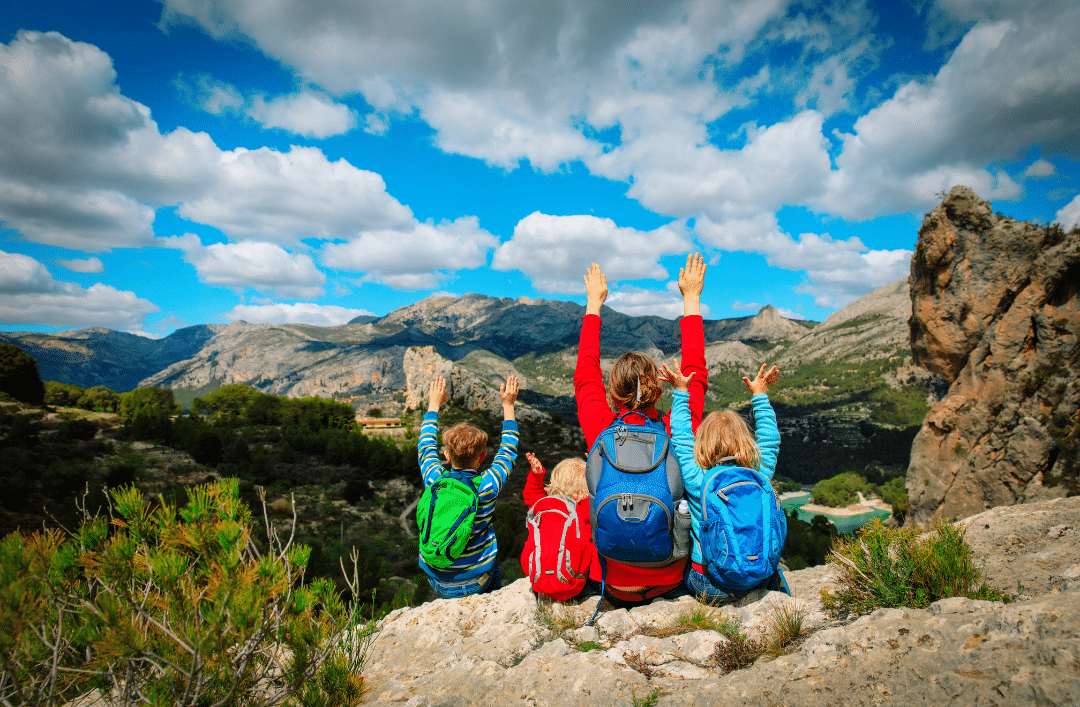
Residential Resort Cumbre del Sol offers an unparalleled location nestled between the sea and the mountains, giving you the opportunity to enjoy nature year-round. Now that the temperatures have dropped a little and the weather is still good, it’s the perfect season for hiking. We’ve already mentioned some of the most famous routes on the coast, but this time, we’re ready to conquer the mountains. We remind you to always consider your level of experience, take necessary precautions and carry all the necessary equipment (hiking shoes, water, sunscreen, etc.) Are you ready? Here we go!
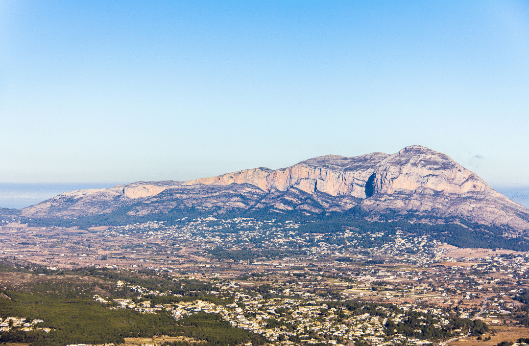
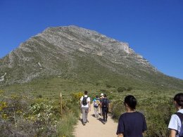
The Montgó Natural Park, shaped like an elephant with its trunk extended towards the sea, is a symbol of Denia’s surroundings. It offers 6 trekking routes, of varying lengths and intensity, and is the perfect place for you to conquer mountains alongside your family. Most of the trails allow you to reach the top and enjoy impressive views. We recommend the Cova de l’Aigua and Racó del Bou route as it is circular and of medium difficulty. It is 5.5 kilometers long and you’ll need about 3 ½ hours to return to your starting point. The route begins at the hermitage that was built in the 80s, next to the Pare Pere hut. This route allows you to see the cave where water was stored and takes you through the shady area of Montgó, declared a micro-reserve.
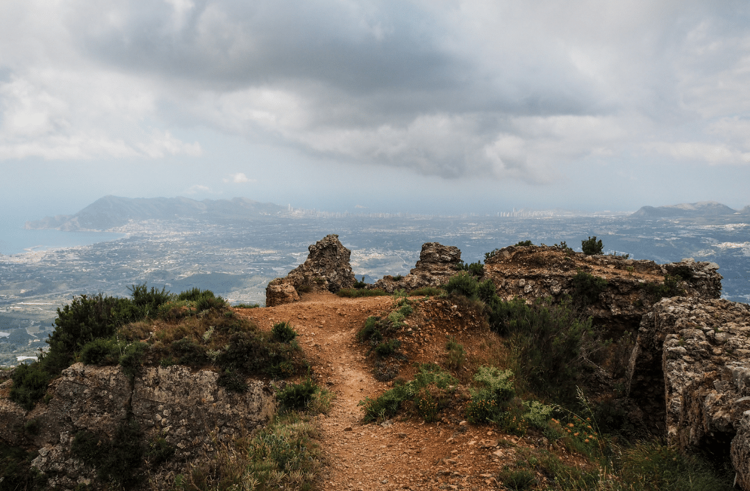
Another option is to go to Altea and leave your car at the Casas de Bèrnia, a small village in the town of Xaló. The Serra de Bèrnia circular route, also called El Forat de Bèrnia route, is a medium level hike and is known to be the most interesting and complete in the province of Alicante. This route is a little longer than the previous one, as it is 9 km long and takes 4-5 hours. It offers amazing landscapes, and multiple natural attractions, such as El Forat (a natural tunnel allowing you will cross the mountain range), as well as heritage sites such as El Fort de Bèrnia. Don’t forget to take a flashlight to be able to cross the tunnel!
If you’re at expert hiker, we can offer two challenges: The Barranc de l’Infern and the Puig Campana ascent. These two routes require a lot of training, so we recommend you to walk carefully and opt out if you don’t have the right level.
The Barranc de L’Infern, also referred to as the ‘catedral del senderismo,’ is one of the most unique and popular circular routes in the province of Alicante. It requires great physical strength as it has 6,800 stone steps that lead you to stunning landscapes and a great cultural heritage. The starting point is located in Fleix and from there, you’ll have to follow the PR-CV 147 trail marks (after the Fleix washhouse). The route is winding and takes you across the Barranc de l’Infern twice. Keep in mind that after heavy rains it is very likely that you won’t be able to cross the ravine, so we recommend you wait a few days.
We’re sure this mountain has caught your attention several times. The Puig Campana is the second highest peak in the province of Alicante, with an altitude of 1,408 meters, and one of the most demanding routes. You can climb to the top (15 km) or take the circular route (12 km). To start your climb, you’ll need to go towards the Font del Molí in Finestrat and follow the PR-CV 289 (Volta al Puig Campana) route in an anticlockwise direction as the path is more irregular and it is preferable to do it uphill. You can follow this trail until the end if you’re only interested in the circular route, or change course at the Coll del Pouet crossing to climb to the top. There is also a more strenuous path that passes by the south slope, that’s to say by the quarry, and is known as the “Vertical Kilometer”.
Finally, if you like to go trekking and camping in the mountains, you can climb a section of the Gran Ruta Costa Blanca Interior (GR-330) that passes near your home: Denia-Gata de Gorgos and Gata de Gorgos-Parcent. Hiking is a great activity as you can get exercise and connect with nature. Don’t forget your equipment, check the weather and remember that we must take care of the environment and leave the least no footprint behind. Respect the environment and conquer the heights of one of the most impressive mountains in the Valencian Community.
If you want to know more about Cumbre del Sol and its surroundings, don’t miss our blog articles and be sure to follow us on our social media accounts.
Feb 15, 2016 | Events, Other towns

Montgò Trekking
Today we want to suggest a guided hiking tour through the Montgó Mountain organized by Xàbia’s Hiking center.
The guided tour is taking place on Sunday 21 February at 08:00 h., kicking off from Jesus Pobre at 08:00 h. and arriving at Jávea’s Shooting Range at about 14:00 h., making it a 6 hours long tour. (more…)

Jan 23, 2016 | Events, Other towns
Montgò Trekking
Today we would like to invite you to a free and very healthy activity to be organized in Xàbia: an excursion to the Montgó Mountain on Sunday 24 January 2016 at 08:00 h. The gathering point is Jávea’s Shooting (5, San Jeronimo / Denia road, Phone number +34 965 792 632).
Montgó massif rises above the plains of Javea, Denia and Ondara and reaches a maximum height of 753 m. above sea level. It is east-west oriented and is conformed mainly by large limestone walls that define their appearance, making it one of the most unique places on the east coast environment. (more…)
May 15, 2012 | Events, Other towns

Hiking trails in Javea
This month, the town of Jávea is organizing guided hiking trail activities that Cumbre del Sol neighbors might find interesting because these activities will take place just 11 Km from the development.
Granadella Cove – Castell trail via Teuleria (PR-CV354)
This free of charge activity will take place on Sunday 27 May at 09:00 h. from the Granadella Cove parking in Jávea.
People who want to participate in this activity must be on the meeting place (the parking) at 9:00 o’clock. It is not necessary to register in advance and the approximate time which takes this route to be completed is 3 hours.
(more…)
